




~VROMI Encourages Residents to Explore the St. Martin Climate Impact Atlas~
PHILIPSBURG:--- As the Meteorological Department of St. Maarten (MDS) warns of a high risk of excessive heat from July through September 2026, the Ministry of Public Housing, Spatial Planning, Environment and Infrastructure (VROMI) is encouraging residents to take the necessary precautions during periods of extreme heat while also increasing awareness of how climate change is impacting the communities in which they live and work.
According to the Meteorological Department, above-normal temperatures, warmer nights and an increased likelihood of heatwaves are expected over the coming months. These conditions can increase the risk of heat-related illnesses while placing additional pressure on public health, water resources, energy demand, infrastructure and the island's natural environment. As climate change increases the frequency and intensity of extreme weather, understanding where climate risks occur is becoming just as important as responding to weather alerts.
Know Your Community. Understand Your Climate Risk.
One way residents can better prepare is by exploring the St. Martin Climate Impact Atlas, VROMI's interactive online platform that helps users understand how climate hazards may affect different communities across the island.
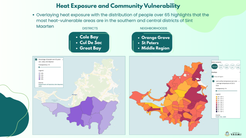
The map above illustrates one example from the Atlas, highlighting areas where heat exposure overlaps with members of St. Maarten’s community who are over the age of 65. By combining temperature data with social and demographic data, the Atlas helps identify which communities may face greater risks during prolonged periods of extreme heat.
To help better prepare for a changing climate, Minister Gumbs is encouraging the public to explore the St. Martin Climate Impact Atlas, a free, interactive online platform that transforms complex climate data into practical, easy-to-understand information.
Whether you are making decisions for your home, business, school, or community, the Climate Impact Atlas provides valuable information to help you understand local climate risks and make more informed choices.
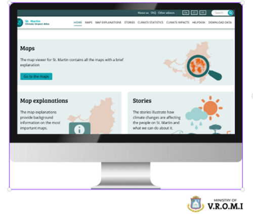 Through the Climate Impact Atlas, users can:
• Explore interactive maps showing areas vulnerable to extreme heat, flooding, sea level rise, coastal erosion, drought and other climate hazards.
• Learn how climate risks vary across different neighborhoods across the island.
• Better understand how climate change may affect homes, businesses, critical infrastructure and ecosystems.
• Access climate stories, interactive maps and planning information designed for both the general public and technical professionals.
Explore the Climate Impact Atlas
Scan the QR code below to explore the St. Martin Climate Impact Atlas and discover how climate change may affect your neighborhood, your community and the island as a whole.