


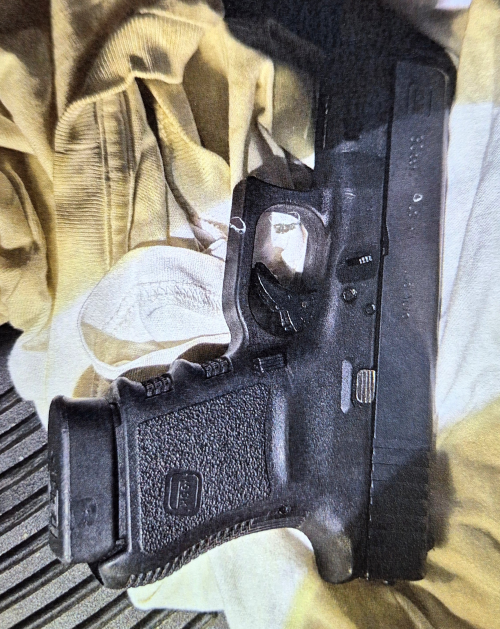
 PHILIPSBURG:--- The Police Force of Sint Maarten (KPSM) arrested five male suspects during the early hours of Wednesday, July 1, 2026, during a patrol in the Dutch Quarter area.
At approximately 3:30 a.m., police officers conducting routine patrols along Brasilia Road observed a black Hyundai i10 carrying five male occupants. Officers became suspicious after noticing that two of the men inside the vehicle were dressed entirely in black and had their faces covered.
Given the unusual circumstances, officers decided to stop and inspect the vehicle. Due to the number of occupants and in the interest of officer safety, additional police patrols were requested to assist at the scene.
Acting under KPSM's stop-and-search authority, as well as the provisions of the Firearms Ordinance and the Opium (Drugs) Ordinance, officers conducted a thorough search of both the occupants and the vehicle.
During the search, officers discovered and confiscated a firearm along with several other items believed to be intended for use in criminal activities. As a result, all five occupants were immediately arrested.
The suspects, identified by their initials J.A., F.F.L., S.R., G. de l. R., A.M.N., and V.J.R., were transported to the Philipsburg Police Station, where they remain in custody for questioning pending the ongoing investigation.
The firearm, the additional items recovered during the search, and the Hyundai i10 have all been seized as evidence.
Detectives are actively investigating the circumstances surrounding this case, including the firearm's origin and the suspects' intentions when they were stopped.
KPSM continues to intensify proactive patrols across the island as part of its ongoing efforts to prevent violent crime and ensure community safety and security. The Police Force encourages the public to remain vigilant and to report any suspicious activity by contacting the police dispatch center at +1 (721) 542-2222 or the anonymous tip line at 9300.
 PHILIPSBURG:--- Megaleios Communications + Consultancy has
  PHILIPSBURG:--- The Police Force of St. Maarten (KPSM)
 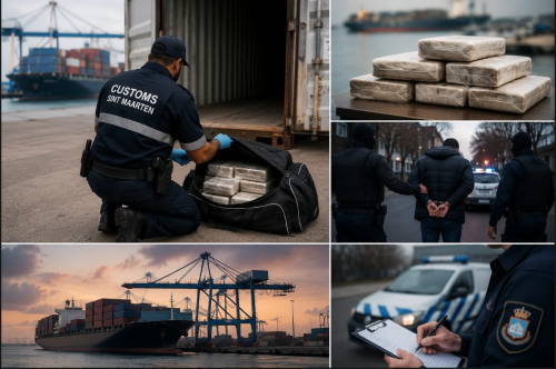 PHILIPSBURG:--- Customs Sint Maarten intercepted 20 kilograms of cocaine during an inspection of an in-transit container vessel at Port St. Maarten on April 18, 2026. The seizure ultimately led to the arrest of two suspects in the Netherlands on suspicion of involvement in the importation of the narcotics.